



The winds in the Canary Islands are expected to weaken in early September, giving way to the calmer weather typical for this time of year. While August is concluding, the warm weather is set to continue for several more weeks. However, temperatures are already noticeably lower than in July. This month is known for its light winds and smooth seas, with larger tides and cooler temperatures compared to previous months. Some islands may also receive a bit of rain at the start of September.
The State Meteorological Agency (Aemet) has provided the weather forecast for the last days of August:
Sunday: In mountainous northern areas, expect cloudy intervals with a low chance of light, sporadic rain in the northeast of La Palma and Tenerife. Other regions will be mostly clear, with some cloud cover in the evenings over Lanzarote and Fuerteventura. Temperatures will remain stable, with slight increases in the minimums in the interior of the larger islands. Moderate winds from the northeast will be strong at times on the southeast and northwest slopes of the mountains. Central Tenerife will experience moderate winds from the southwest, which may become strong later in the afternoon.
Monday: The north of the islands will be cloudy, gradually clearing to mostly sunny in the eastern isles during the day. Cloud cover is expected to break in the mountains around midday, while the rest remain mostly clear. Temperatures will not change much, but 30°C could be reached in the southeast of Lanzarote and Fuerteventura, southern Gran Canaria, and low areas in southern Tenerife. Moderate northeast winds will be strong on the mountain slopes, with gentle breezes along the southern and southwestern coasts.
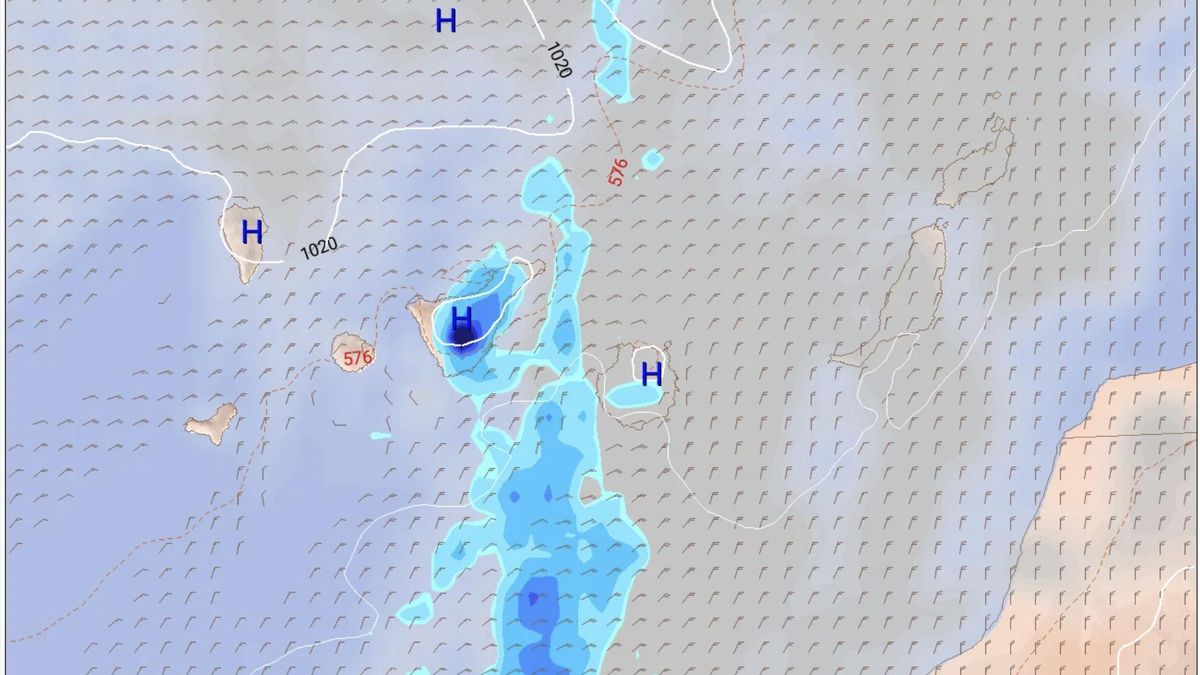
September Forecast: Although uncertainty surrounds the forecast, the European weather model (ECMWF) suggests that Tuesday, September 1, will mirror the last days of August, featuring northern winds and mostly clear skies with no rain expected early in the day. However, cloud cover will likely increase in the afternoon, especially in the central islands, potentially bringing some rain to mountainous areas of Tenerife and Gran Canaria.
According to Aemet, in the north of the larger islands, clouds will dominate, but clearer conditions will prevail in the afternoon. Minimum temperatures will remain stable, while maximums could see slight increases in inland and southern areas. Winds will be moderate from the northeast, increasing in strength on the southeast and northwest slopes of the mountains later in the day.
On Wednesday, cloud cover is predicted to persist, intensifying throughout the day, accompanied by continued northern and northeastern winds. By mid-morning, showers are anticipated across much of Tenerife, particularly in the south-central region, with lesser amounts in central and western Gran Canaria. The forecast indicates cloudy conditions in northern areas, gradually shifting to intervals of clearer weather after midday, with minimal changes in temperatures or slight cooling in the eastern islands. Moderate northeast winds will continue, with strong gusts possible in mountain regions.
Thursday will see cloudiness remain in parts of the archipelago with the possibility of rain, especially in Tenerife. Winds will continue from the north but will weaken in the western islands.
On Friday, winds are expected to drop further, which is typical for this time of year, with renewed chances of rain in Gran Canaria and especially in central and eastern Tenerife.